In our world of aviation we get the data in all forms and many different digital formats. To support the most commonly used, the SDK uses:
- WGS-84 Latitude / Longitude Coordinates with GeoCoordinate and GeoCoordinateBasic
- Universal Transverse Mercator coordinate system (UTM Map Projection)
- North American Datum of 1983 (NAD83)
If we are working in a CAD environment, most of the time a cartesian coordinate system is used and our earth is an ellipsoid. So there is a need to convert between the ellipsoid coordinate (WGS-84 Lat/Long) to a map projection like UTM or NAD-83.
The SDK offers conversions back and forth between these coordinate systems and this is accessed by methods from the GeoCoordinate struct named:
Below is an example of converting N36:00:00, W124:00:00 to a NAD-83 coordinate
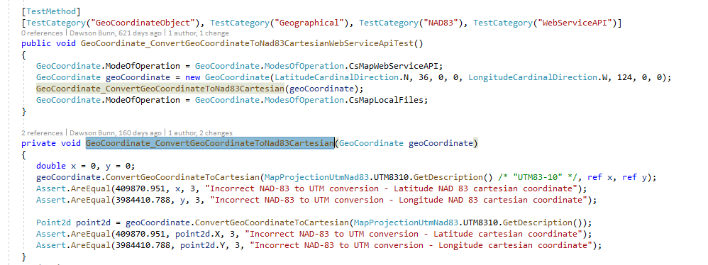
Internal Unit Test Source Code
This coordinate system API part of the SDK is used to add extra features to the FPAssistant Suite. When using some of the other API to construct graphics (GeoLine, GeoPoint, etc.) internally the maths is calculated in a cartesian plan using UTM and then once complete conversion to Geo Lat/Long coordinates allows the data to be presented back to the calling program.
For further details, examples or help then please make contact.


